Clay mineralogy of bauxites and paleosols formed during regional subaerial exposures of Adriatic Carbonate Platform
Leaders: Goran Durn, Franz Ottner, Andrea Mindszenty, Josip Tišljar & Marta Mileusnić
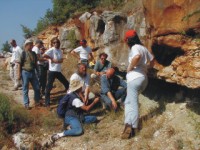
ISTRIA
Istria is the biggest Croatian Peninsula. It is situated in the north part of the eastern Adriatic cost. Carbonate deposits of the Istria exhibit numerous exposure surfaces reflecting emergence. On this field trip subaerial exposure surfaces associated with bauxites and palaeosols will be presented. Special attention will be given to clay mineralogy, sedimentology, geochemistry and the micromorphology of these materials. The following will be presented:
(1) Clayey bauxites associated with Kimmeridgian to Early Tithonian emergence
(bauxite pit Mondolaco near Rovinj, western Istria)
 Mondolaco bauxite deposit occurs at the contact of
Upper Oxfordian-Lower Kimmeridgian and Upper Tithonian strata in an
apparent stratigraphic gap of a relatively short duration (about 6 MY).
It is highly argillaceous. Major minerals are boehmite, kaolinite,
haematite, anatase and minor chlorite. Possible sources of bauxite
parent material are the dissolution residue of the host carbonates plus
windblown dust, as well as fine-grained volcanoclastic material.
Greenish-grey to yellow clay intercalations in the coverbeds may be
signs of ephemeral exposure or, alternatively represent clay influx from
adjoining slightly more highly elevated areas.
Mondolaco bauxite deposit occurs at the contact of
Upper Oxfordian-Lower Kimmeridgian and Upper Tithonian strata in an
apparent stratigraphic gap of a relatively short duration (about 6 MY).
It is highly argillaceous. Major minerals are boehmite, kaolinite,
haematite, anatase and minor chlorite. Possible sources of bauxite
parent material are the dissolution residue of the host carbonates plus
windblown dust, as well as fine-grained volcanoclastic material.
Greenish-grey to yellow clay intercalations in the coverbeds may be
signs of ephemeral exposure or, alternatively represent clay influx from
adjoining slightly more highly elevated areas.
(2) Greenish-gray clays associated with Late Aptian - Late Albian regional emergence
(Tri Jezerca quarry near Selina village, central Istria)
 Greenish-grey clays associated with Late Aptian
regional emersion ranges in thickness from several centimetres up to 1
meter and are considered paleosols when show evidence of pedogenesis.
The clay mineral composition of these paleosols clearly indicates the
influence of both pedogenic and diagenetic processes. The colour of
paleosols, the presence of root remains only in the upper part of
profile and high abundance of pyrite with very low values of d34S may
imply that they were probably seasonally marshy soils to permanently
waterlogged soils.
Greenish-grey clays associated with Late Aptian
regional emersion ranges in thickness from several centimetres up to 1
meter and are considered paleosols when show evidence of pedogenesis.
The clay mineral composition of these paleosols clearly indicates the
influence of both pedogenic and diagenetic processes. The colour of
paleosols, the presence of root remains only in the upper part of
profile and high abundance of pyrite with very low values of d34S may
imply that they were probably seasonally marshy soils to permanently
waterlogged soils.
(3) Relict polygenetic terra rossa soil
( Novigrad town area, western Istria)
 The Novigrad profile is situated on the coast of
Novigrad bay, NW from Novigrad town. It represents a polygenetic terra
rossa soil about 150 cm thick situated on limestone of Lower Cretaceous
age (Upper Albian). Dominant mineral phases in the clay fraction of the
Novigrad profile are kaolinites (KlD and Kl), and illitic material,
while vermiculite, mixed-layer clay minerals and quartz are present in
subordinate amounts. Field description of the profile and performed
analyses indicate that formation of terra rossa began in an interglacial
period older than the Eemian.
The Novigrad profile is situated on the coast of
Novigrad bay, NW from Novigrad town. It represents a polygenetic terra
rossa soil about 150 cm thick situated on limestone of Lower Cretaceous
age (Upper Albian). Dominant mineral phases in the clay fraction of the
Novigrad profile are kaolinites (KlD and Kl), and illitic material,
while vermiculite, mixed-layer clay minerals and quartz are present in
subordinate amounts. Field description of the profile and performed
analyses indicate that formation of terra rossa began in an interglacial
period older than the Eemian.
Duration: 1 day
Start: Friday, September 22, at 8:00 in front of the Grand Hotel Adriatic in Opatija
End: Friday, September 22, at 20:00 in front of the Grand Hotel Adriatic in Opatija
Number of Participants: Minimum: 15; Maximum: 45
Recommended outfit: trainers/hiking shoes, sun hat, wind/rain jacket and boots (in the case of rain)
Transportation: bus
Registration: before July 15, 2006
Excursion fee: 70 EUR (includes: transportation, lunch in the restaurant and refreshments in the bus)
Important note:
Participants will be accommodated in Opatija, and therefore should organize their accommodation during the field trip themselves through the Hotel Reservation Form. Fieldtrip fee does not cover your hotel accommodation.
Additional information:
Goran Durn
Faculty of Mining, Geology and Petroleum Engineering
Pierottijeva 6, HR-10000 Zagreb, Croatia
Phone: +385 1 4605 400, Fax: +385 1 4836 057
E-mail: gdurn@rgn.hr
Ceramic and brick clays deposits and excessive flysch erosion
Leaders: Radovan Avanić, Boris Kruk, Žejko Kastmüller & Marta Mileusnić
(1) Deposit of ceramic clays “Ivoševićev Gaj”
Deposit of ceramic clays “Ivoševićev Gaj” is located on the north-western slopes of Petrova gora, to the north-east of town of Vojnić. Clays are used as raw material for tile and sanitary ware production by company Inker d.d. from Zaprešić, which is a part of Hussar Holding group from Vienna. Yellow or grey plastic clays occur as lenses within sands, gravels and silts of Plio-Pleistocene age. According to chemical analyses clays contain 69 to 79% of SiO2 and 14-28% of Al2O3. The most abundant clay minerals are kaolinite (15-28%) and illite (10-20%) while montmorillonite is present in smaller concentration (10%). On the first stop of excursion, in “Ivošević Gaj” deposit, contact of clays and overlaying sediments will be shown.
(2) Deposit of brick clays “Rečica“
“Rečica“ is, important deposit of brick clay, with reserves of 4 500 000 m3, located in Kupa river valley near the town of Karlovac. It consist of up to 11m thick, differently coloured, layers of clay which are underlain by aquiferous sands and gravels. Main mineral constituents of the clay are quartz, illite, mica and smectite while limonite, kaolinite, chlorite and feldspars are less abundant. According to granulometric measurements clay fraction content is high (42-54%), therefore in the brick making process quartz sand and sawdust are added. The deposit is exploited by Wienerberger-Ilovac d.d. company. Short presentation of the company, in duration up to half an hour, will be held during the visit to the deposit and brick factory where the production process will be explained.
(3) Excessive flysch erosion - Slani potok
Significant amount of Mid-Eocene flysch is present in the costal parts of Croatia. In the whole region flysch is subjected to the erosion to lesser or greater extent. However, there is excessive flysch erosion in Slani potok («Salt creek») catchment which, together with accompanying landslides, covers the area of approx. 3 km2. At this location, the total site degradation takes place forming terrains of «badlands» type. Slani potok flysch contain muscovite and illitic material, quartz, calcite, feldspars, chlorite, kaolinite, smectite and pyrite. Small particles sizes prevail. Phenomenon of efflorescent salt crust of sodium sulphate (thenardite) on flysch in Slani potok during dry period of the year is unique in the area. Occurrence of this water soluble mineral, indicates that some components of flysch encompass sodium, which accelerates disintegration followed by intensive erosion. Illustrated appearance of thenardite is the first finding of this mineral in Croatia. Excessive erosion of Slani potok flysch complex occurs due to: lithological composition dominantly presented with fines including nanometer particles, group of materials known as hard soil – soft rock, presence of swelling minerals, pore water rich in sodium, and presence of sodium mineral – thenardite.
Duration: 1 day
Start: Friday, September 22, at 7.00 in front of the Grand Hotel Adriatic in Opatija
End: Friday, September 22, at 20.00 in front of the Grand Hotel Adriatic in Opatija
Number of Participants: Minimum: 15; Maximum: 45
Recommended outfit:
trainers/hiking shoes, sun hat, wind/rain jacket and boots (in the case of rain)
Transportation: bus
Registration: before July 15, 2006
Excursion fee: 70 EUR (includes: transportation, lunch in the restaurant and refreshments in the bus)
Important note:
Participants will be accommodated in Opatija, and therefore should organize their accommodation during the field trip themselves through the Hotel Reservation Form. Fieldtrip fee does not cover your hotel accommodation.
Additional information:
| Marta Mileusnić |
Darko Tibljaš |
| Faculty of Mining, Geology and Petroleum Engineering | Faculty of Science |
|
Pierottijeva 6 HR-10000 Zagreb, Croatia |
Horvatovac bb HR-10000 Zagreb, Croatia |
| Phone: +385 1 4605 400, Fax: +385 1 4836 057 | Phone: +385 1 4605 970, Fax: 4605 998 |
| E-mail: marta.mileusnic@rgn.hr | E-mail : dtibljas@jagor.srce.hr |
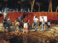
Clay Minerals and Selected Ecological Aspects of Soils on the Island Veli Brijun, Croatia
Leaders: Franz Ottner, Tomislav Erstić & Monika Sieghardt
BRIJUNI
The Brijuni islands, found along the south-western coast of Istria, were proclaimed a national park in 1983. They cover an area of 2,700 acres, and total fourteen larger and small islands, of which the largest are Veli and Mali Brijun. The main characteristic of the Brijuni archipelago is the extraordinary biological diversity given thanks to its geographical location, its geological base and geomorphology, its diversity of the habitat and its island isolation. The natural biological diversity was enriched by men’s traditional husbandry. Veliki Brijun, as the largest island of the archipelago, which was cultivated into a harmonious landscape of meadows and parks, has along with the preserved vegetation types typical for Mediterranean and sub-Mediterranean climate also the rich remnants of architectural heritage, a zoo, pheasant farm and safari park with numerous diverse forms of animal life from throughout the world. Traces of human inhabitation on the island date back to the earlier Neolithic period and among the many archaeological sites, the most significant is the pre-historic settlement on Gradina hill. Remains of a typical summer residence and temple from Roman times in the Verige Gulf, and on the western shore, very valuable ruins dating from the late ancient-Byzantine period and the Byzantine basilica of St. Mary dating from the sixth century are located on the western coast of the island. The fieldtrip to Veli Brijun includes:
(1) Scientific/professional visit
The arboretum "Putevima mira" was set up in 1987 on the island "Veliki Brijuni" with the ambition to give a floristic overview not only of the Mediterranean flora, but also of trees and bushes from totally different climate zones. Investigations of the soils of the arboretum and of some coast sections have been made. The results are an essential foundation for the elaboration of potential concepts for the continuation of the arboretum. The investigations comprehended beside relevant parameters like C, N, S, P, C/N-rate, pH-value, also total mineral and clay mineral analysis and grain size analyses of the soil-profiles. The arboretum was mapped properly and among others maps there are two longitudinal sections, a plan who shows the depth of the arboretum-soils and a plan which documents the position of the „dense clay-layer“.
In three to four profiles the terra rossa soil of the island can be seen. Mineralogical analyses show illite and kaolinite - poorly crystallized - as the main clay minerals in the soils. Vermiculite and mixed layer minerals are seldom, smectite and chlorite couldn’t be found. In general the soils show a decrease of illite and an increase of vermiculite in the deeper part of the profiles caused by illitisation processes on the soil surface.
Solifluction processes are visible in profile 4. It can be seen, that in the past the soil moved from higher parts of the island down to the coast. In two profiles (5 and 6) the influence of man to the normal soil profile is visible. For a better growth of foreign plants 30 to 50 cm of terra rossa soil was poured onto the existing soil and buried the natural A-horizon.
Technical tests show the very dense clay layer in deeps of about 50 cm. That dense structure and the small porosity (similar to clay deposits) are unfavourable for “exotic” plants.
(2) Sightseeing of the island under an expert guidance:
The following sights will be seen: olive tree (IV A.D.), pine ally (1905), safari park, footprints of dinosaurs, a Roman country residence situated in the Verige Bay (I century A.D.), a natural-science collection and photo exhibition "Tito on Brijuni", as well as church of St. Germaine (XV C.) with an exhibition of murals and Istrian and Kvarner Glagolitic writings.
Duration: 1 day
Start: Saturday, September 23, at 7:00 in front of the Grand Hotel Adriatic in Opatija
End:Saturday, September 23, at 20:00 in front of the Grand Hotel Adriatic in Opatija
Number of Participants: Minimum: 15; Maximum: 45
Recommended outfit: Trekking shoes, sun hat, raincoat and boots (in the case of rain)
Transportation: Bus
Registration: before July 15, 2006
Excursion fee: 80 EUR (includes: transportation, lunch in the restaurant and refreshments in the bus)
Important note:
Participants will be accommodated in Opatija, and therefore should organize their accommodation during the field trip themselves through the Hotel Reservation Form. Fieldtrip fee does not cover your hotel accommodation.
Additional information:
| Marta Mileusnić |
Franz Ottner |
| Faculty of Mining, Geology and Petroleum Engineering | Institut für Angewandte Geologie |
|
Pierottijeva 6 HR-10000 Zagreb, Croatia |
Peter Jordan Strasse 70 A-1190 Wien, Austria |
| Phone: +385 1 4605 400, Fax: +385 1 4836 057 | Phone: +43 1 47654 5407 or 5410 |
| E-mail: marta.mileusnic@rgn.hr | E-mail : franz.ottner@boku.ac.at |